Here are a couple quick tutorials that may make this whole process super easy.


Here are a couple quick tutorials that may make this whole process super easy.
I knew there was a map post that was exactly what I was looking for. It just took me a bit to find it. This is the best one I’ve seen yet.
The problem that I run into with that method is that you can only load a very small section of terrain; I don’t know exactly how much but it looks like maybe a square mile.
I found that out last night. I couldn’t get the entire area I needed in the small frame it uses. I will keep trying different ways and keep posting my progress.
The link in that other post no longer works. Or it’s just not working right now.
Try this one.
http://googlemaps.github.io/js-samples/styledmaps/wizard/index.htmlI don’t know if I would follow that tutorial. It might be good for a rough model but the topography in google earth is highly in-accurate. You would be much better off using a GIS application. There is a free one called qGIS which is perfectly capable of reading all the data needed for one of these maps. It’s not the easiest way but it will provide the best results. You can export to SVG straight from the software. Most states/countries offer this information publicly.
@dystracktd I can probably point you to a specific source if you need one.
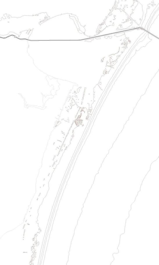
Here is one that I am messing around with created completely in Illustrator. It’s more of a bathymetric than a topographic - but, the land in this area (Padre Island) is basically completely flat so their isn’t much sense in trying to even put topographic data on it. I’m envisioning it using 7 layers of 1/16th material. I’ve done a few things that will make it more difficult to put together but I think really enhance the assembled design.
Nice! The little bits will be a pain to assemble. Unless that are cut outs? If they’re peaks I would either make them all the same shape so you don’t have to be super organized or just score/raster them it might achieve the same effect.
They will be a pain to assemble! It’s a unique area with tons of islands - and a fairly large area for this type of map. What I did on an underlying layer was copy the paths and set them to mark/engrave, basically creating a place holder for them. My thought was to be able to cut them in order on their own sheet (yes, largely a waste of a sheet) and then use some kind of adhesive paper to pick everything up and remove the waste section. After that, I I would have a perfectly matching layout and could remove and place within the marked boundaries - tweezers probably mandatory.
I downloaded qGIS. It was a little difficult to figure out but I finally got it. I liked that you can save it directly to a DXF cutter file. From there I imported it into Inkscape to clean it up a bit. I am almost finished and will be cutting it out soon. I will post it when it’s done.
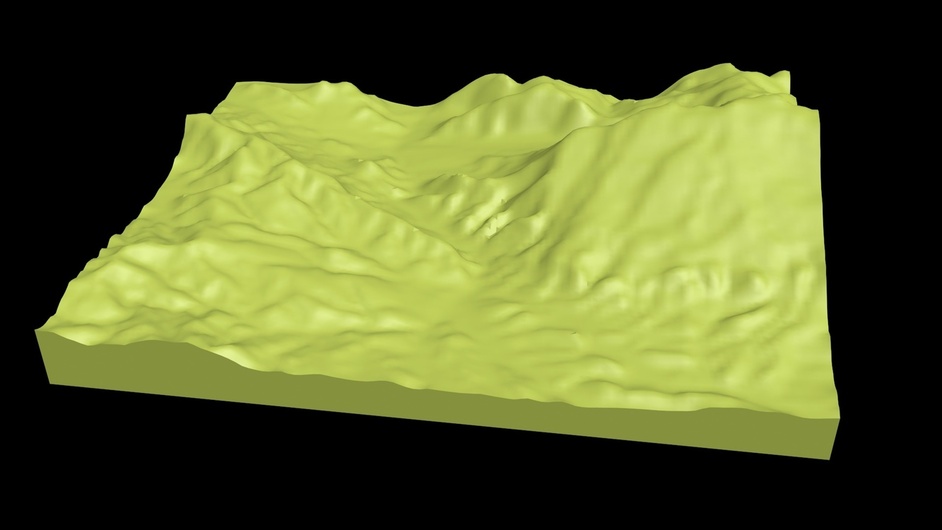
Here’s a tool that I use for creating 3D printed landscapes:
http://jthatch.com/Terrain2STL
It uses the terrain layer from the Google Maps API and generates an STL file that can be imported into Fusion, TinkerCad, etc. as well as “slicer” software, e.g. Cura, Slic3r, NetFabb, etc.
Here’s a map that I printed of the Boulder, CO area:
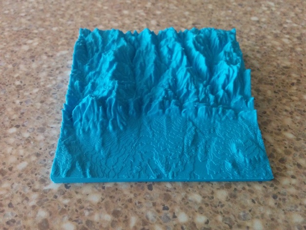
Very cool!
Thought I recognized the Flat Irons. Thanks for that link!
Amazing resource. This should make some cool projects a lot easier. Thanks for the link! Love that print, by the way.
Perfect. Used that method before and it works well. The result will be spectacular! Can’t wait to see it!
Bookmarked!! Thanks!!
Bookmarked. Cant wait to try that site later.