Awesome! Happy to hear it worked well for you and that you used the custom label option ![]()
1 Like
I love this idea - I have friends who moved to a new place so I’m going to use this to give them a housewarming gift ![]()
QA things
1: If you look at the preview and then click the back button to return to the edit screen even though the boxes will still show things turned off, the items reappear
(Eg. Turn off City Labels or Contours - go to preview, come back to edit, the boxes will be empty but you’ll see the lines/names)
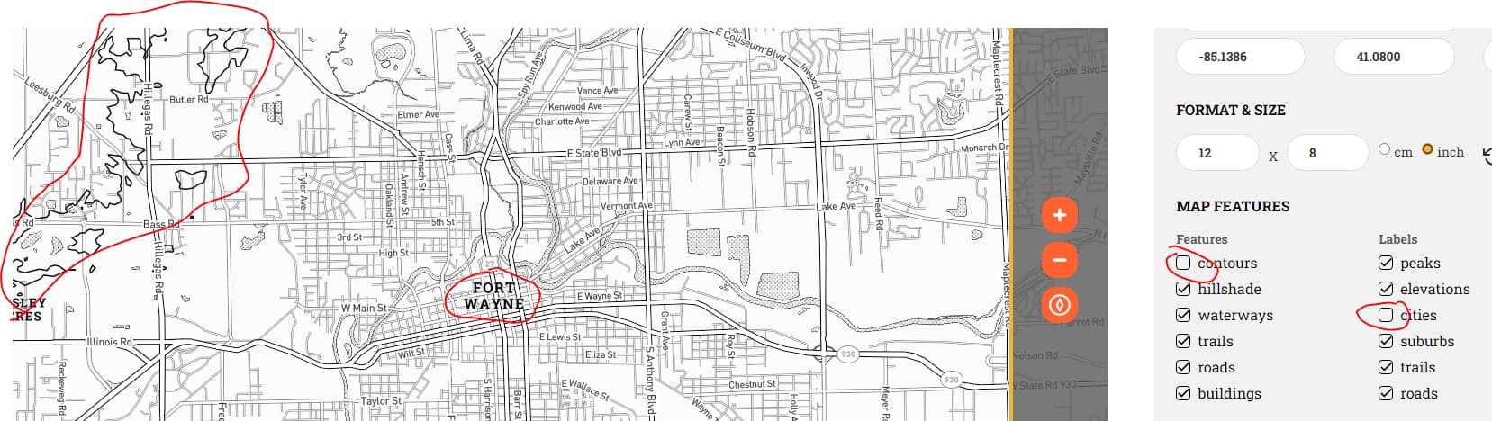
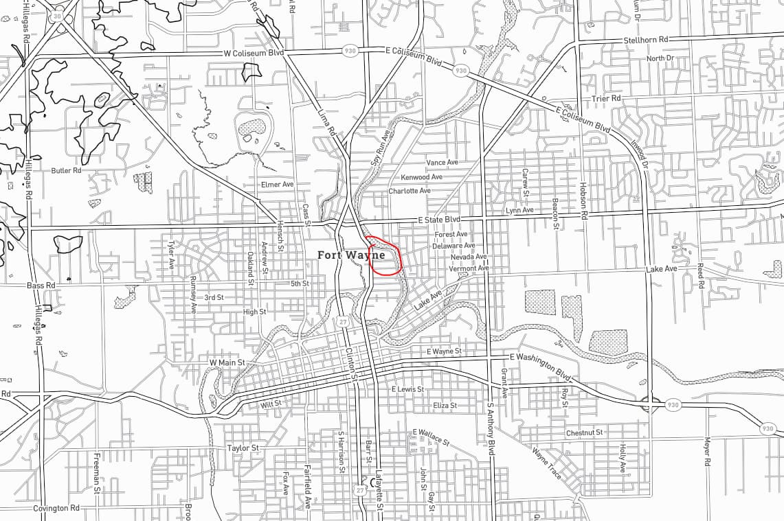
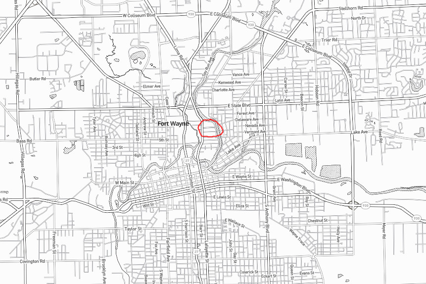
2: The size and placement of the labels is likely important, and they move.
Edit Screen:
Download:
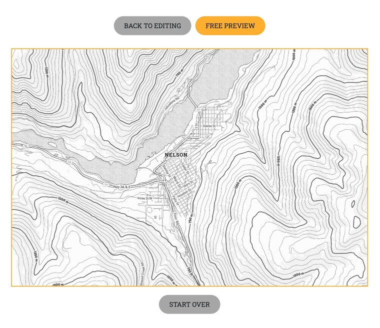
Now, I haven’t done the hi-res download yet, because the preview is showing me something I don’t want…so it may be fixed there, but is should be fixed in the preview as well.
This is on Windows 10 21H2 19044.1586/Chrome 100.0.4896.75 (Official Build) (64-bit)
Thanks!
3 Likes
Thanks for the excellent feedback @deirdrebeth - I am aware that there are currently some issues when using the back button and sometimes a page refresh is needed to make sure its showing the correct layers again based on the checkboxes selected - I have added it to the bugs list.
The label feature is a bit slippery with its placement on the live map and will likely become another step where it is placed onto the preview map before generating the high res one - what you see on the preview map is what you will get on the high res one so you can position your label a bit offset on the live map and then confirm it looks correct on the preview
The label feature is still quite new and I realize still needs some refinement - your feedback is very helpful and I have added another ticket to look further into fixing that issue.
3 Likes
It might be easier to add a “return to editing” button next to the “start over” that reloads the page automatically ![]()
2 Likes
Very nice resource indeed, but one thing is missing - at least where I live. Railroads! This is Biel/Bienne, Switzerland, and I drew the railroads (crudely) in in red to show where they should be…

4 Likes
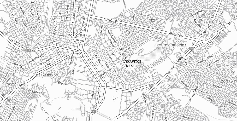
Another issue: In non-English-speaking places, there’s a mix of local and English names: Here’s Athens - some names are properly in Greek (e.g. Αλεξάνδρασ), other labels are in Latin (Lykavitos, Kerameikos) or even English (“Athens” instead of “Αθήνα”). This is probably due to the base data from openstreetmap, but would be nice to be adjustable.
3 Likes
Thanks Ade, I will take a look into adding a railway layer into the map design as they are descriptive landmark patterns in many places. Thanks for your feedback.
The dataset is indeed provided by Open Street Maps and you can suggest changes or add fixes via this page https://www.openstreetmap.org/fixthemap
Alternatively you can hide the labels and use our custom label tool to add back the ones you want in your language of preference
5 Likes
Thought so - although OSM has the proper Greek labels in Athens… is there a setting in the API maybe?
I love this idea!
I really wanted to make a map of Westcliffe, Colorado, for a gift for someone.
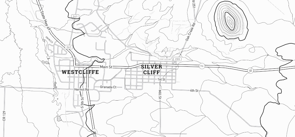
But it isn’t showing Westcliffe. It has Silver Cliff which is just to the East of Westcliffe.
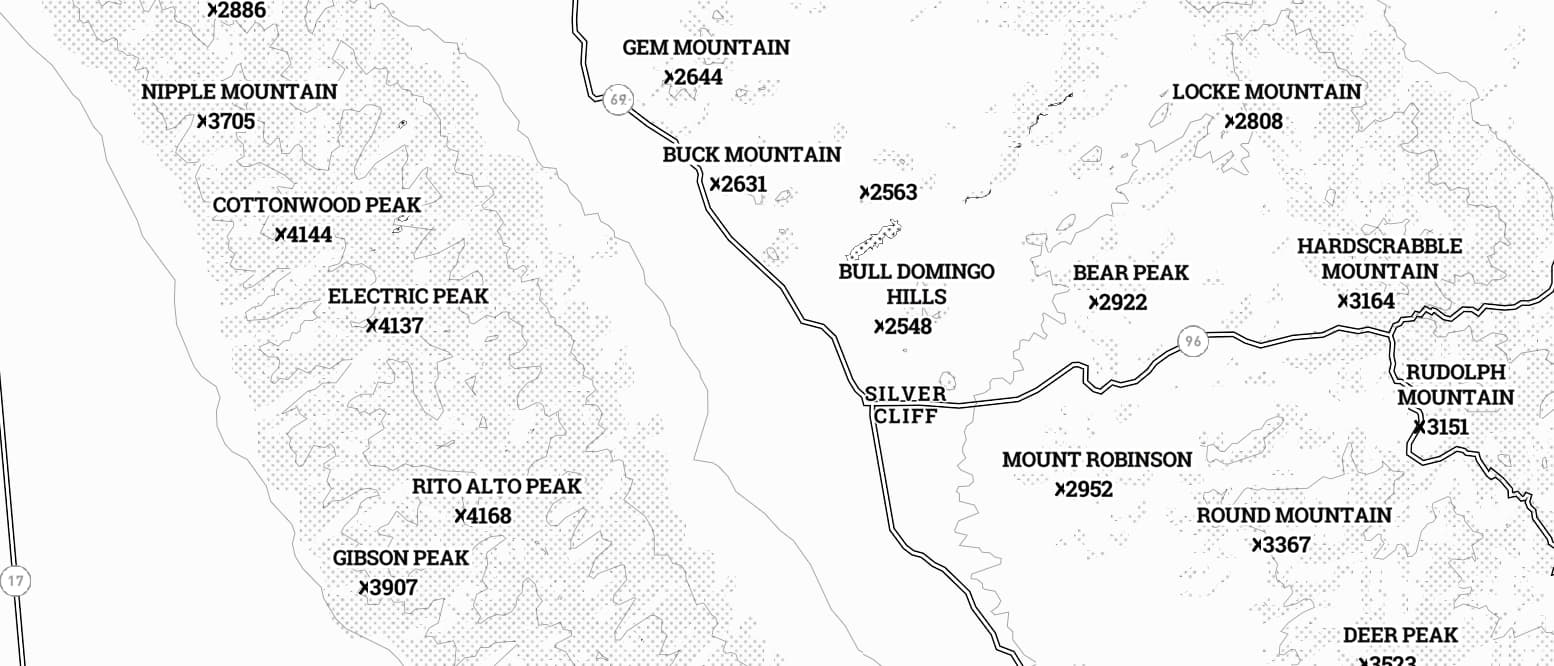
This is where it is
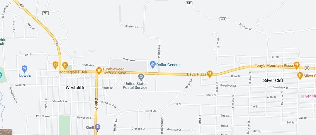
But here’s how it looks in the app, it only lists Silver Cliff.
I will have to check it out more later and see if I maybe want to do it a different way.
I don’t know, I tried that and it didn’t work on my screen
Thanks ![]()
Mapbox markers and labels have collision avoidance so that they never end up stacked on top of each other. This means that sometimes a peak name will prevent a city name showing until you are zoomed in further and the focus becomes more on city and street names.
Something that has worked for me in the past is to right click and rotate the map to see if you can find a sweet spot where the labels you want line up and are shown at the same time. You can also use this along with the zoom buttons to gradually zoom in until the label you are looking for is shown.
You can also use the custom label tool to add in a place label that has disappeared.
3 Likes
thanks for the tips!
1 Like
I love this idea, but where I live is flat as a pancake.
2 Likes
I would like to know where I can get the high quality maple cutting boards?
This user is in Canada, so their source for cutting boards may not be useful for you. A quick Google search for maple cutting boards turns up lots of options.
2 Likes
You just need lines based on inches of elevation and a different color for negative inches.
![]()
1 Like
@shannon.hobbs we have used several different sources for good quality boards - I am waiting on an order from https://www.wholesalecuttingboards.com/ to be delivered that look to be good quality, great selection and decent pricing - I believe they deliver to both Canada and US.
3 Likes
Thank you! I wish they had prices posted on their website.