That us such a great idea!
1 Like
It seems that all all lines have a large stroke. When I tried to edit a downloaded SVG the file was very cumbersome and I had similar problems. Instead of trying to edit the SVG to something manageable, I found it easier just to use a PDF from the website in illustrator. Then use select "same " option to get all roads and rivers that i wanted to include.
How did I miss these the first time round? They look great!
1 Like
That got me heading in the right direction. I only started using Illustrator when the Glowforge arrived so I am far from comfortable with it. But I was able to get the PDF to open and with many trials and errors I was finally able to get a basic one to score and cut. Now to work on more detail.
Thanks for the help.
Jason
1 Like
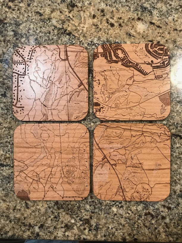
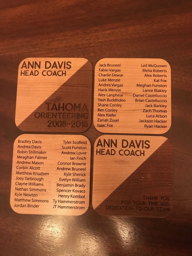
Your coasters turned out great, I love the graphic quality of the maps! I am in love with maps and as a coach of an orienteering team I made a set of coasters for another coach. These feature our local trails. I had the GIS files, but the work to edit in illustrator was going to be massive so I thought what the heck let’s really test out that engrave feature. I just used a pdf that I saved as a jpg and etched. it took nearly 50 min per front due to the tiny detail but these came out really nice on the finished cherry.
17 Likes
Very nice! You could almost slip one into a pocket and use it for a map instead of the real thing. (No folding. Yay!) 
1 Like
Yes the detail is so fine that it put a soft line on the terrain lines almost like it just scratched the finish but cool effect and the trail names and distances are mostly readable though super tiny I could definitely navigate off these I was blown away by how well it worked.
As for graphic maps some artistic maps might be easier from scratch then using gis files or other types of map files like cad maps since often the trails are different strokes such as dashed that glowforge can’t read and the symbols may not transfer or scale across especially map files with gis data and spreadsheets behind them there is a lot of things that would be hard to graphically edit. and possibly easier to recreate exactly as you like using the map file as a base layer to trace art over. Different processes for different uses, but a jpg works great if you want everything shown.
4 Likes
Just an FYI, many people have had issues with compression artifacts in their jpg files that show up as “extra” engraving. It obviously worked for you, but you should be able to print straight from pdf or convert it to png.
1 Like
They look awesome!
These are awesome! How did you make the words and lines black?
@ebrennan i’m kinda obsessed with figuring how to do this now. i feel I’m close to getting the file ready to engrave/score but not quite. The streets are transparent and made up from the black parts (negative space). So my street lines are not filled in and so don’t want the end result to be double lines and hollow in the center of the lines. I use SCAL4 and just downloaded Inkscape to see if that could work with reverting the colors but it didn’t work. 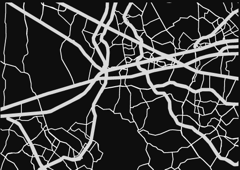
thanks!
From your description it sounds like your file is made up of a bunch of black shapes on a white background.
Easy fix:
You could invert it like you mentioned, however you first need to rasterize this so it is an image file instead of what you currently have. You can do this in Ink Scape or simply just export as .png or .jpg then reopen and invert. Then you will be engraving the inverted image.
Other way:
If you wanted to keep the file a vector you could put a shape (I would just make a rectangle the size of your material in any color) behind your black shapes. Then cut all the black shapes away from the rectangle. In Illustrator this is called “Pathfinder>Remove Front”. I believe it is fairly similar in Inkscape. This will result in tiny line shapes that are all connected like a spider web and you can set the engrave depth to your preference.
Hope this helped.
1 Like
If I were to guess, your image scaled to your document size in different proportions to the stroke. When opening the file in Illustrator, take note of the scale option boxes.