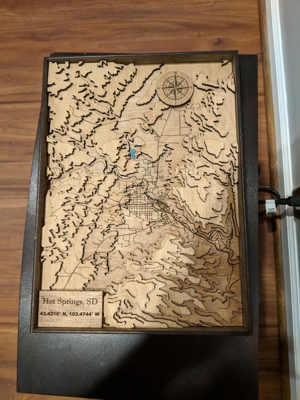
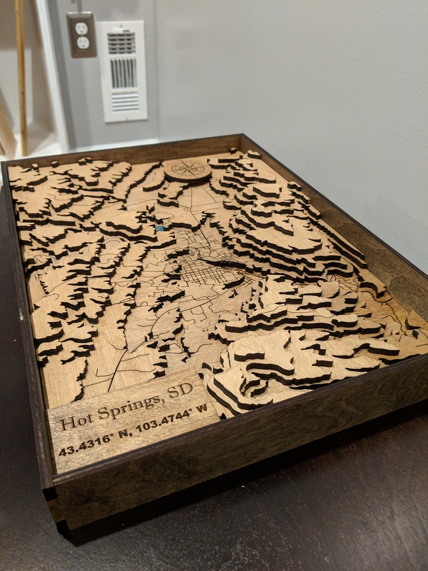
Made this for a Xmas gift. First time working with GIS software but it turned out pretty good.
36 Likes
Great job! 
1 Like
That came out nice. What is the over all size?
1 Like
Looks great to me! Well done!
1 Like
Turned out great.
1 Like
Wonderful detail!
1 Like
Thanks. Overall size is 11x14.5 inch
1 Like
Nice turn out!
Sweet! Turned out fantastic.
Looks great. Can you please share how you got the data to do this? I’m trying to understand the process. Thank you very much.
Thanks, I used this guide from a separate thread to start:
https://theshamblog.com/a-wooden-laser-cut-topo-map-of-portland-me/
Sourcing the DEM data file and the vector file for the roads was a matter of searching online.
The DEM files can usually be found searching multiple GIS sites for the state/location in question. I actually had to stitch a few files together in the GIS software to cover the region I wanted.
I used the census site for the road file and then cropped based on the limits of the map I was producing.
https://www.census.gov/geo/maps-data/data/tiger.html
Hope that helps!
1 Like
Thanks. I’d definitely file this under the “holy crap I have 1 week to figure this out because I procrastinate too much” file 
1 Like
So incredibly helpful Jon, my sincere thanks 