This build took a lot longer than I expected, but I’m pretty happy with the results!
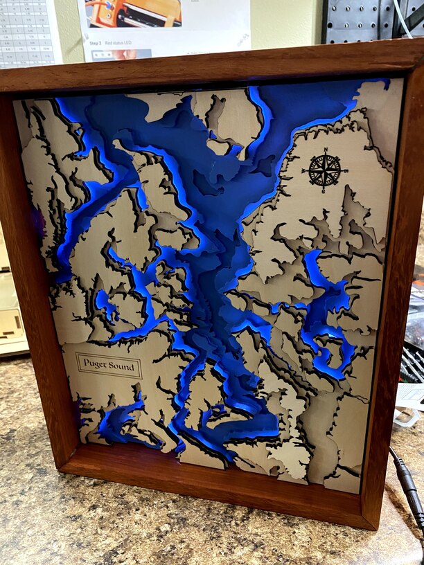
Almost as soon as we got our Glowforge, my son wanted to build a topographic map of the Puget Sound area (we live in Seattle). But, he wanted it backlit between the water and land layers. I thought, okay, we can do this…
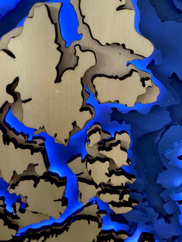
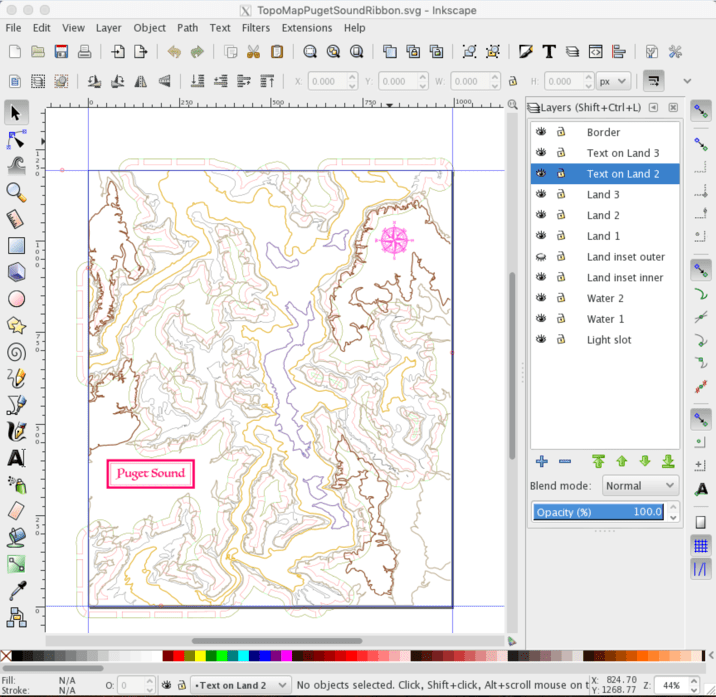
I started with digital elevation data from the USGS, and processed it in QGIS to generate a series of vectors, one for each elevation contour. I brought those into Inkscape, and cleaned them up - substantially simplifying the profile of the coastline, lest there be a large number of tiny loose wood pieces all along the coast.
There are seven layers of wood here: Three water layers in draftboard (painted blue), three land layers (in basswood plywood), and a standoff layer in between the water and land. The standoff coastline profile is inset from the lowest land layer, so you can’t see it, but serves to provide a gap between the land and water for the light to shine through.
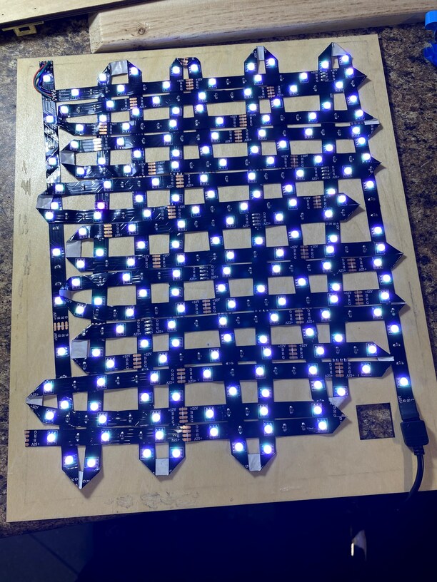
Underneath the entire map, there is a crisscrossing mesh of LED strips mounted on another sheet of plywood serving as the back of the assembly. The color, brightness, etc. can be controlled with a little remote control.
In order for the light to shine through the map, just inside the coastline there is a series of slots, following the contour of the coast, running all the way down through the three land layers. This took a fair bit of fiddling in Inkscape to get right.
The frame was not built on the Glowforge but was probably the hardest part of the build (for me) – it is African Padauk which we sawed and glued together, not without a fair bit of trial and error. (This is not stained - this is the natural color of the wood!) The map is mounted to the frame using a set of plywood tabs on the inside of the frame, and the back is held in place using a few small brass screws. Finally, both inside and outside the frame, I used gaffer tape to seal up any cracks so the lights would not shine through the assembly.
Now I can see why people sell things like this for hundreds of dollars on Etsy! I’ll write up a more detailed blog post on the build at some point and post it here.

