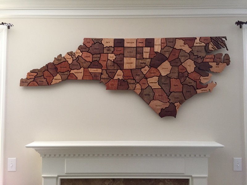
Inspiring project tutorial of an impressive CNC laser-cut wooden map of North Carolina and its 100 individual counties.
14 Likes
For those of you interested in carving / engraving maps, here is a link that has maps of all the states. Files include boundaries (state outline and political boundaries), rivers, roads, railroads, lakes,etc. including polygon and line format. There are also World map files and U.S. Continental files
10 Likes
Bookmarked - thanks!
1 Like