Who cares about bed size limitations any more! My new goal is to throw that constraint out the window and just make bigger and better things with my Basic.
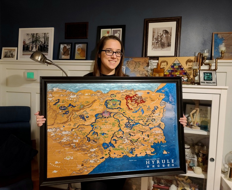
My first map of all time was a hand-painted Hyrule map. That was nice and all but now I make way better maps! I needed to make a resin map and I needed to make it HUGE. Heres a link to my first map.
This map consists of 10 cherry plywood panels that nest into a 2’ x 3’ frame. There is about 2 pounds of Alumilite resin, 5 legit hours of hand painting, and at least 973 hours of Cricut vinyl weeding to add all the words.
I made this because I wanted the map over my bed. Man, did it turn out awesome!
As always, here is the video!
Have a great day everyone!
Nicole C
When Geeks Craft
hahahahah you are weirdly not the first person to say that. its a really cool space. I have been thinking about doing more live stream stuff on the channel or on twitch. basically just a live stream of me working lol but i dont know how entertaining that would be.
I sent you an email last year (I think), but I’d love to get some advice from you on engraving imagery some time. Have you ever tried using imagery as a map layer instead of vector layers?
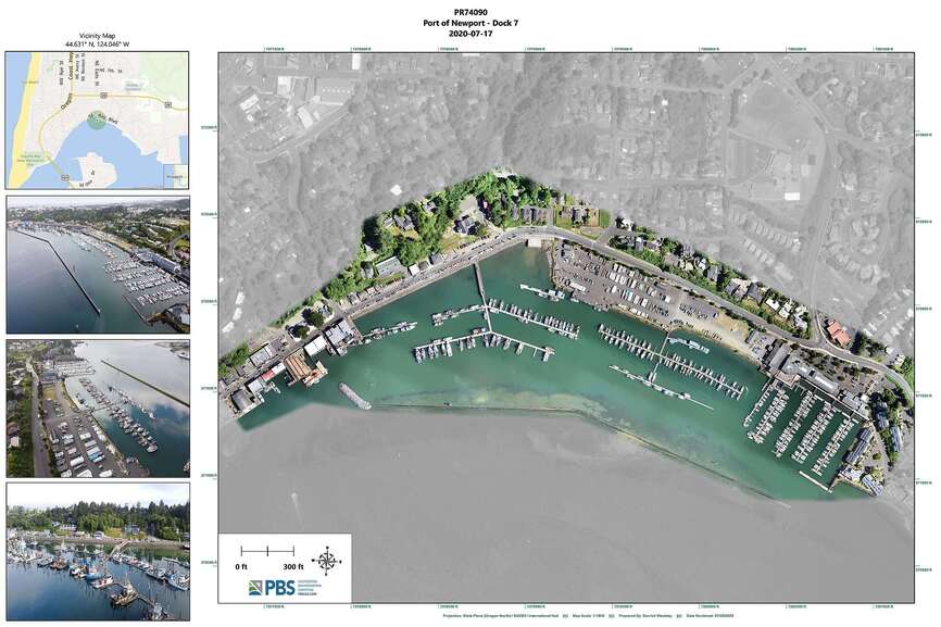
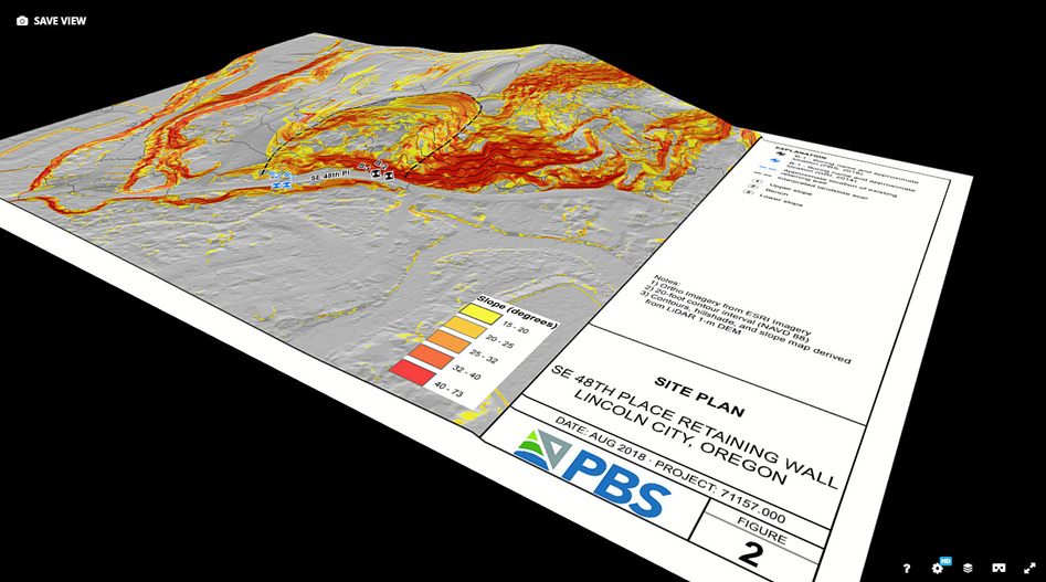
I do photogrammetric aerial mapping for an engineering/surveying firm and the main reason I got the glowforge is to make 3d topo maps with drone imagery and drone-derived terrain. I feel like I have a good workflow to put everything together how I want EXCEPT I’ve never been able to get the imagery itself to engrave with any kind of clarity.
if you did, I apologize that I don’t remember! the only “Imagery” I have used on maps is the occasional PNG instead of SVG to help the glowforge’s brain handle a large picture better on maps specifically. I have engraved photos before and I have found that switching from ‘convert to dots’ to VARY POWER creates a muchhhhhhhhh bettttttter image. like significantly better. I also try to use a lot of LPI.
can you post an example photo of what you are trying to engrave?
I found the same re: “vary power”, but more LPI always ends up with really dark images. I’ve played around a lot with exposure, contrast, gamma, transparency, etc and have never found a setting that gets anywhere close to what I’m hoping for.
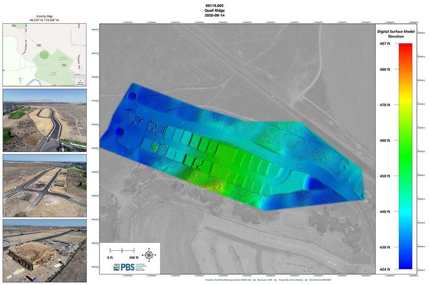
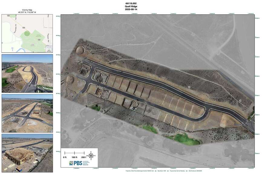
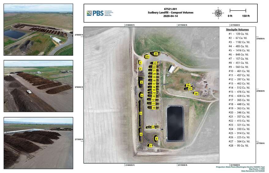
These aren’t maps that are prepped for the engraver, but here’s some examples of the type of maps I make. (Had to reduce the resolution and DPI a lot to upload, fyi. Most of these are 24x36in 300DPI)