They will be a pain to assemble! It’s a unique area with tons of islands - and a fairly large area for this type of map. What I did on an underlying layer was copy the paths and set them to mark/engrave, basically creating a place holder for them. My thought was to be able to cut them in order on their own sheet (yes, largely a waste of a sheet) and then use some kind of adhesive paper to pick everything up and remove the waste section. After that, I I would have a perfectly matching layout and could remove and place within the marked boundaries - tweezers probably mandatory.
1 Like
I downloaded qGIS. It was a little difficult to figure out but I finally got it. I liked that you can save it directly to a DXF cutter file. From there I imported it into Inkscape to clean it up a bit. I am almost finished and will be cutting it out soon. I will post it when it’s done.
3 Likes
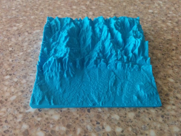
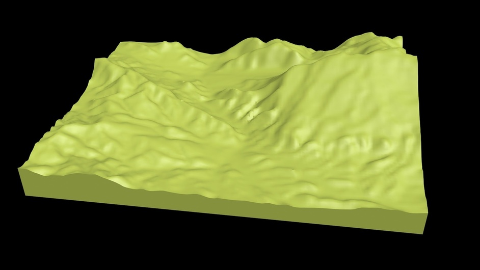
Here’s a tool that I use for creating 3D printed landscapes:
http://jthatch.com/Terrain2STL
It uses the terrain layer from the Google Maps API and generates an STL file that can be imported into Fusion, TinkerCad, etc. as well as “slicer” software, e.g. Cura, Slic3r, NetFabb, etc.
Here’s a map that I printed of the Boulder, CO area:
21 Likes
Very cool!
Thought I recognized the Flat Irons. Thanks for that link!
1 Like
Amazing resource. This should make some cool projects a lot easier. Thanks for the link! Love that print, by the way.
1 Like
Perfect. Used that method before and it works well. The result will be spectacular! Can’t wait to see it!
2 Likes
Bookmarked!! Thanks!!
Bookmarked. Cant wait to try that site later.
Here is another site for making maps I found today. https://www.mapbox.com/
5 Likes