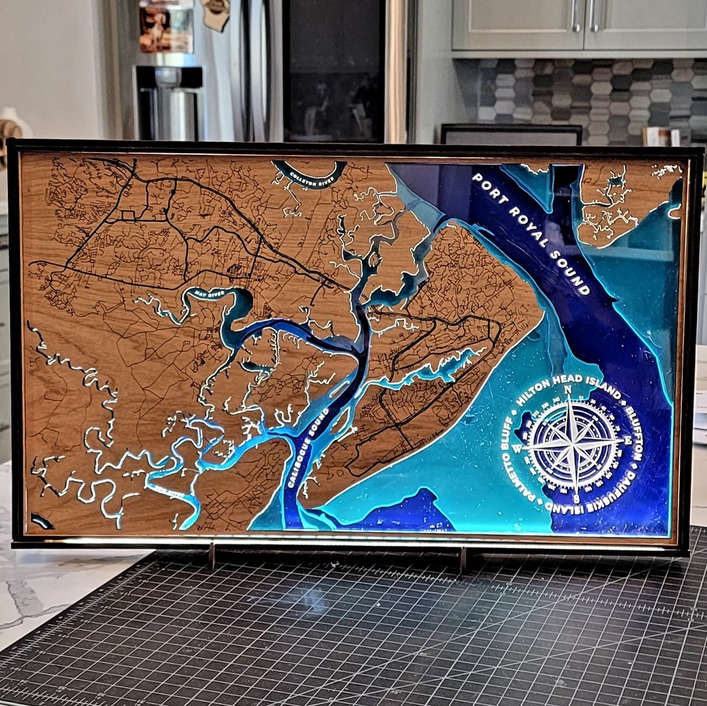
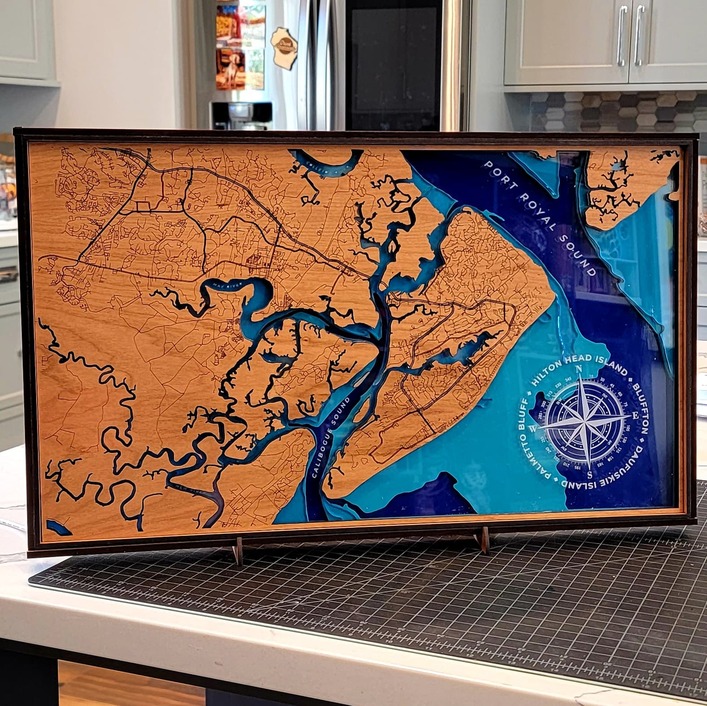
LED strip embedded into the frame of this multi-layered bathymetric map using a combination of proof grade plywood and acrylic. I just moved to the area a few months ago and had to do a map.
78 Likes
Wow, that turned out great!
5 Likes
Really makes it pop!
6 Likes
Hay I’ve been there. Great job.
6 Likes
Super nice map!
6 Likes
Love the addition of the LED. That really makes this piece stand out among maps, thats for sure.
6 Likes
That is just spectacular!
4 Likes
Curious, is that compass true north, weird picture angle, or just skewed somehow?
Overall nice looking map.
6 Likes
Very snazzy!
4 Likes
Love it!
1 Like
Was referring to the compass.
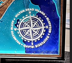
True north, weird picture angle, or skewed?
6 Likes
Yes.
Magnetic North is ~5º West of true North at that location. Most nautical charts use it.
1 Like
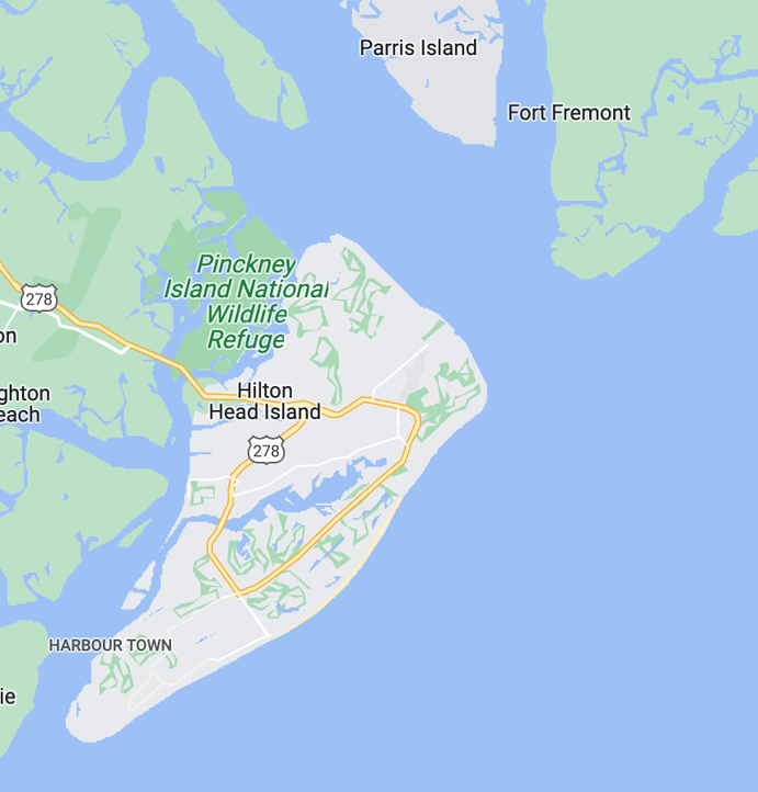
Here is one of the maps I used to create the bathymetric layers, and you can see the compass here I used as reference.
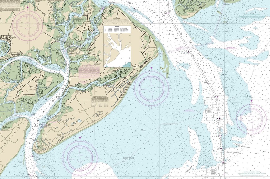
5 Likes
Fun fact. In 1820 MagVar here in Hardy County WV was zero degrees, and interestingly the population center of the U.S. was also here. The U.S. was populated much differently than now. Both the population center and zero MagVar have slowly drifted west over the past 200 years. Today, MagVar in Hardy County is more than 10 degrees from true north. Zero MagVar is now in central Missouri which coincidentally also includes the new population center, Wright County, Missouri.
Flat earthers and little green alien chasers might deduce that people give off a strong magnetic field. Ooh! Now I understand the tin foil hats.
9 Likes
Always learning something new here. Thanks.
7 Likes
This is beautiful! I love the two blues and the engraving. Adding light … wow!
3 Likes
The magnetic pole drifts by many miles per year, and has flipped many times in the past. It’s not out of the realm of possibility for it to occur again in our lifetimes.
The printed nautical maps usually have dates to show when they were calculated. You’ll also note there is a geographical “North” on the compass rose on official maps. The sample shared above shows it.
3 Likes
Oh god, don’t get the north-up map debate started. It’s akin to asking Judaism, Islam or Christianity, which one is correct?
6 Likes
Just caught my eye.
Shields Up. Red Alert. Set Phasers To Stun…
1 Like