Honestly, for the maps that I’ve created so far, I’ve hand traced the contour lines in Adobe Illustrator using Wisconsin DNR Maps. It’s not very efficient and takes quite a bit of time, but the results have been good. Technically, these are bathymetric maps, not topographic maps. And I have not found any resources that will give me the lake depth Contours in vector format so I’ve had to map them myself. There are really good resources for topographic maps on getting contour lines for the above ground levels. I’m sure some states actually publish their bathymetric maps online, but unfortunately Wisconsin is not one of those. If you’re going to do it by hand I guess it depends on how many levels you want to create. The first map I did was Lake Mendota which is 83 ft deep and I traced the lines for the depths at every 5 feet which was a lot of layers. The most recent map that I did was only 53 ft and I did it every 10 feet so the process of manually tracing the contour lines didn’t take as long. Hopefully this helps.
Thanks for the info.
I think the color is beautiful as is. Very nice work.
I like both as well, I have these on my radar too.
Is the color painted on?
Yes, acrylic paint.
I like both … But do think the blues could be softer.
My vote is for the blue, but I think it needs to be a little softer. maybe more of a wash.
Can you point me to the file for the cool compass?
I don’t recall where I got the compass rose, but most likely just a simple google image search. Sorry.
There is a very nice one in the free laser designs in your Dashboard.
It’s against forum guidelines to ask for files, even though in this case, obviously a simple google image search will help.
Both are beautiful but I am drawn to the non colored version.
Both look good but I love it with color. I am imagining it on a wall and a pale map wouldn’t look as eye catching.
I agree, the natural tones have a warmer look.
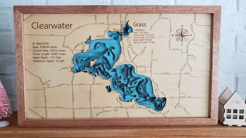
@pubultrastar Fantastic work! I’ve been doing a ton of bathymetric lake maps myself. I’ve done a few in wisconsin, and yes… they are a pain because their bathymetric maps have not been digitized.
Here is an example of one I’ve done recently
Adding the frame is something I need to try, as it looks great.
Where are you get your bathametric files from?
I draw them using illustrator by hand using DNR lake maps. No free public bathymetric data is available for the lakes I did, or at least that i know of.
Love it with the blues!!! Looks really cool!