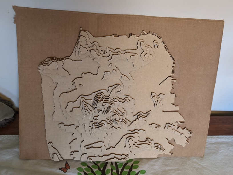
Made my first attempt at a topographic laser cut map.
Still thinking about other features I might add to the final map, but wanted to get some practice cutting and building a layer topographic map.
I used QGIS, data from here , and Illustrator, loosely based on the techniques described here: http://theshamblog.com/making-a-laser-cut-topo-map-the-design-phase/
This was so fun. I’m going to make a lot of these.
49 Likes
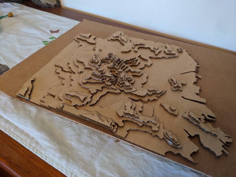
looks great. Lots of pieces to glue
4 Likes
I love topo maps! and thanks for the links.
3 Likes
cynd11
January 22, 2021, 11:59am
4
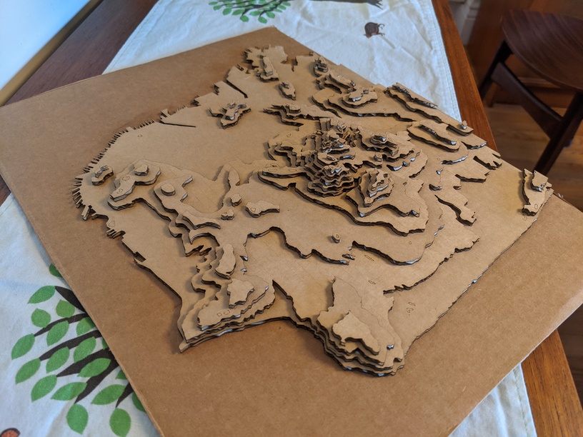
I hate to see such a nice prototype go to waste. Maybe you can spray paint it and/or coat with resin or something, to make it more permanent.
2 Likes
Definitely. I actually kind of like the cardboard look of it
2 Likes
ptodd
January 24, 2021, 9:51am
6
Very nice! I sometimes enjoy using cardboard for the end product. It’s fun and like to recycle.
2 Likes
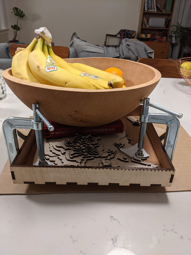
After a few iterations, my “final” version is drying now:
5 Likes
Excellent use if bananas as a weight & measure
5 Likes
GFjim
October 7, 2021, 1:20am
9
This is exactly what I am trying to teach myself to do right now. The learning curve going from inkscape to 3D software is outrageous!
1 Like
Do you mean GIS software? or are you actually using 3D software?
I use GIS (mapping software) to create contours, but still ultimately do a lot of the work in Illustrator (in 2D)
1 Like
GFjim
October 7, 2021, 4:59pm
11
I’m trying to learn sketchup, whichever category that falls into.
That’s actual 3D modeling.
Honestly I don’t know what’s going to be harder to learn GIS or 3D modeling =P both I expect to have a learning curve.
The advantage of 3D modeling is you can use that for lots of other (non-map) projects as well.
Good luck! Let us know how it goes!
1 Like
GFjim
October 7, 2021, 5:03pm
13
Since I don’t know either of them and am struggling to find a good source of DEM info for my area, it is going to be a slow process. I’m debating going back to street maps. LOL
In the past I’ve had real success with this:https://prd-tnm.s3.amazonaws.com/LidarExplorer/index.html#/
Even though it’s for Lidar, I don’t use the Lidar, I select an AOI and download the DEMs.
However, I just tried it, and it wasn’t working :-/ seems to be some error.
In theory you can get the same data from:https://apps.nationalmap.gov/downloader/#/
And right now it says something about an outage… maybe that’s the same issue causing the other error.
I just tried to do a search on that page… and it confirms that there’s the same error… which is actually a good sign, cause probably when this site:https://www.sciencebase.gov/about/
Where are you trying to get DEM data? I’m happy to help point you in the right direction.
3 Likes
GFjim
October 7, 2021, 6:12pm
15
Dem data is great. If I could even find a decent topo I can do it with Inkscape it will just be a long tedious process.
FYI… those USGS sites I linked above are working again
Let me know if you have trouble finding DEM data.
1 Like
Looking good. Now just add a few of the bathymetric ocean layers!
1 Like
GFjim
October 7, 2021, 8:47pm
18
Navigating those sites alone has a learning curve, but I’ll learn.
1 Like