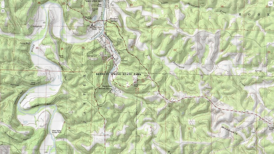
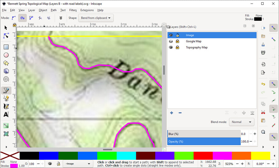
Then I set out to convert it to vectors… but there was way to much noise, and to many lines that I didn’t care about. So I determined that the easiest way to get what I wanted was to manually trace the sections of the map that I wanted. Time consuming, but I ended up with a perfect map for my needs, and each line was already the color I needed it to be.
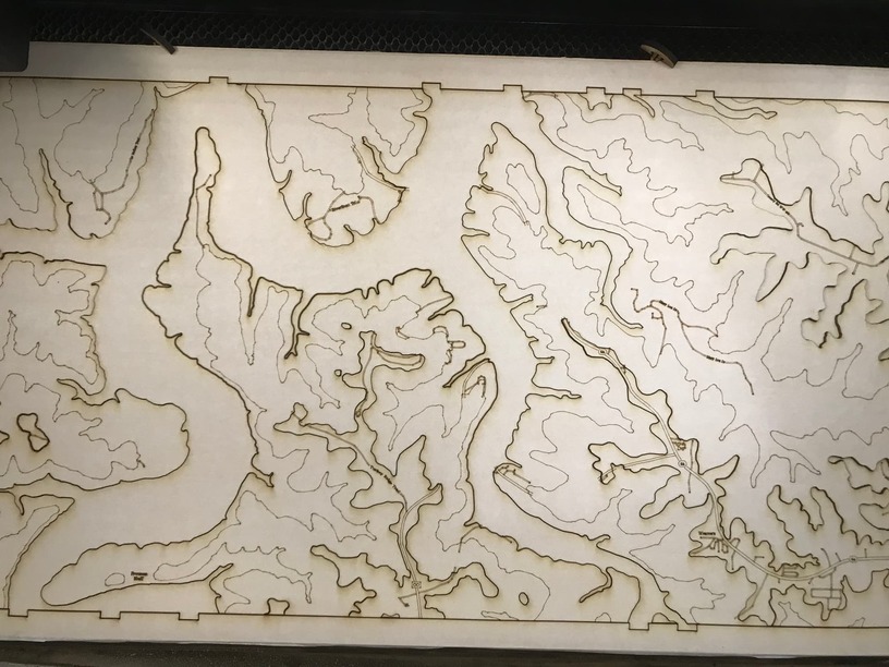
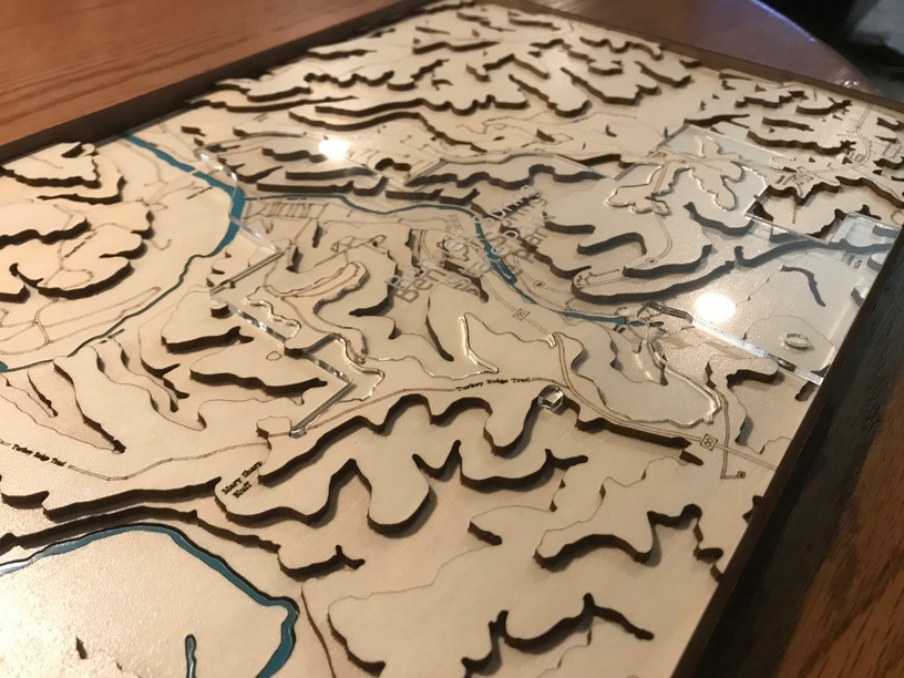
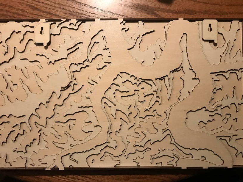
Once the map was “vectorized” I needed it broken up cut and score the sections I needed. This was really easy; I just turned the lines I wanted scored black and left the others to cut.
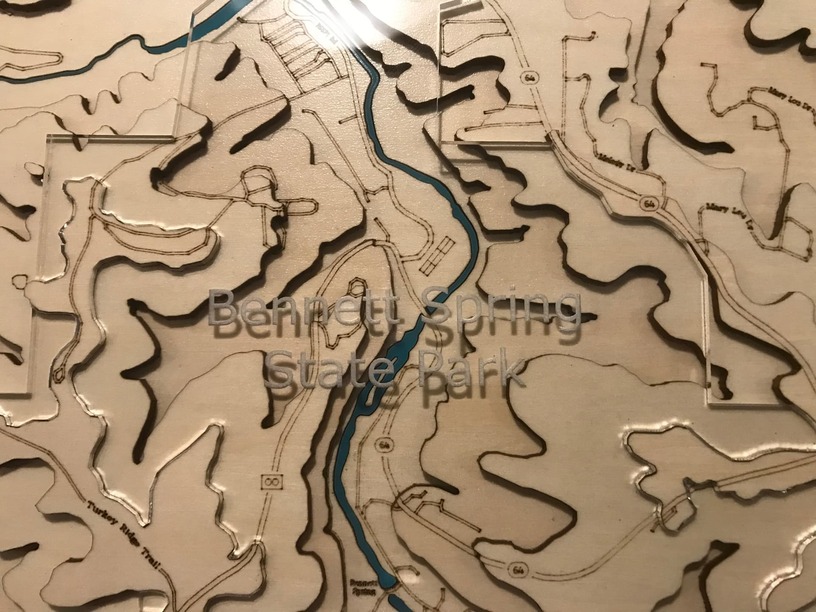
I scored the names of roads and the other labels on the map, but if I do this again I will probably engrave them. I think it would turn out better looking, even if it does take much longer.
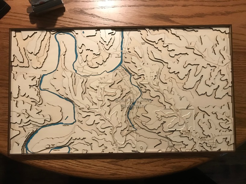
As I was working on it, I thought to myself, “I am never doing this again!” But it actually turned out so nice, if I was asked to do another one, I probably would.
That came out fantastic. They will be thrilled. I love Bennett Springs, it is so beautiful… plus the park ranger and his wife bought a Neapolitan Mastiff from us a few years ago.
I’ve been struggling with a similar project for a couple of years. The topography is actually easy because it’s publicly available, but it’s a private lake community and the bathymetry data is not, and that’s the more important part because I want to make depth layers from blue acetyl sheets.
It’s just an “on the side” project but if I can get it figured out I think it might be the first thing I ever sell, customized for the wealthy homeowners that live there.
Here is another park that has been in the news lately and was literally my backyard when I was in high school. Divers have descended to record depths for a spring, it currently is the deepest known spring in the US and maybe the world.
Ex and I drove up (from ATL) thru the Mark Twain forest to Fort “walk in the woods” for my daughters graduation from BCT in June. ~600 miles each way. As diverse as this country is, it’s amazing how much of it looks the same. Specifically, you could have thought you were in the hills of any of the south-eastern states. You have to go an awfully long way to start to find the differences. I’ve been to every state except the Dakotas and AK.
Paducah, KY, is absolutely charming. We stayed there on the way up, but drove back without stopping.
Your post brought back a flood family memories - my dad used to take the family there every summer for vacation back in the 60s. He taught me and my brother to fly-fish there. I still remember waiting in the mists at dawn in anticipation of the siren that announced the beginning of fishing for the day. It’s a beautiful place that will always be special to me.
I have wanted to do this as well. How, exactly, did you trace the lines? Like, with paper and pencil? Digitally with a mouse? Digitally with a “pen” device? On an iPad? Super curious. I don’t think I could do it with a mouse. Maybe with a pen/stylus type input.
I pasted the image of the map into Inkscape. I created a layer and named it “map” and moved the map image to it. Once I determined the size I wanted it, I switched back to main layer to draw, and zoomed in on the image and started drawing.
I have a brother who would love this. He’s mad about trout fishing and goes to Bennett all the time. Nice work. Some day I need to try this out. I had done some work in the geo database programs but my brain exploded at the learning curve. That was a while ago, so maybe I can figure it out this time.
A good place to get 3D maps is Terrain.party there is the whole world and you can pick from anywhere. This is also great (and has underwater levels, I think) but is only a short time “trial” period.
If you could make it 3D and make it into a few slices with 3D printer software (or Gimp) you could have a real 3D design slopes and all.
I love your park boundaries; what if you scored (heavy) a double line just inside the edges of the acrylic? That would be a subtle but not in-your-face detail.
I’d be so proud if someone did this for me (hint hint, Bellingham WA). (Not that I’m begging or anything…)