I have always been fascinated by maps, and making a laser cut topo or bathymetric map has been in my wish list ever since I got my GF. I finally felt up to the challenge and this is my first attempt.
I browsed here and elsewhere through a lot examples including the fine work by our very own @pubultrastar trying to learn how to get the data and convert it into something useful to send to the GF.
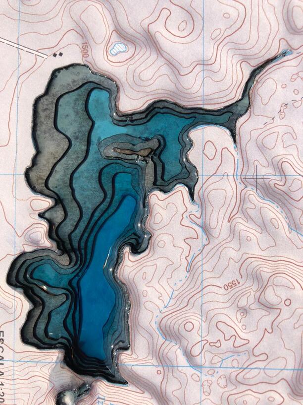
I have learned there is a wealth of topographic and bathymetric data available for Canada and the USA, however only detailed topographic data is available for Mexico, and bathymetric data for only a handful of lakes.
For my first project I chose a small lake I am familar with in the border between México and Guatemala, which happens to bring fond memories because it was one of the fist places I went camping many decades ago.
My original goal was to have layers for both the land altitude (topography) as well as for the water depth (bathymetry) and was halfway through this project having only cut the lake layers when my GF decided to take a break and demand for a new black ribbon lid cable.
So… since it was only my fist prototype, I decided to just print the map on self adhesive paper and finish the lake portion with tinted resin.
In the future I hope to be able to re-make this project as originally conceived, using the lessons learned and with the valuable input from this great community.
It’s beautiful! I hope you are able to execute it as originally planned, and that you will post pictures of that, when it is finished…thank you for sharing this with us!
A beautiful piece! I would guess you could get a good grayscale elevation detail map from here a bit clumsy but works (you have to pan from Sweden). A good variable depth carve from those can get you similar to the graphic but Glowforge style.
Really nice work. I’m also working on a bathymetric/topo map of our favorite campground. (Too many projects!)
I’ve had problems with printed stuff fading in sunlight over time. Have you considered coating it with a transparent UV-resistant coating to extend the life of the top layer?