Top wood layer thin ![]() maple. Depth layers 1/16" MDF. Bottom layer and frame is thick
maple. Depth layers 1/16" MDF. Bottom layer and frame is thick ![]() cherry. Medium
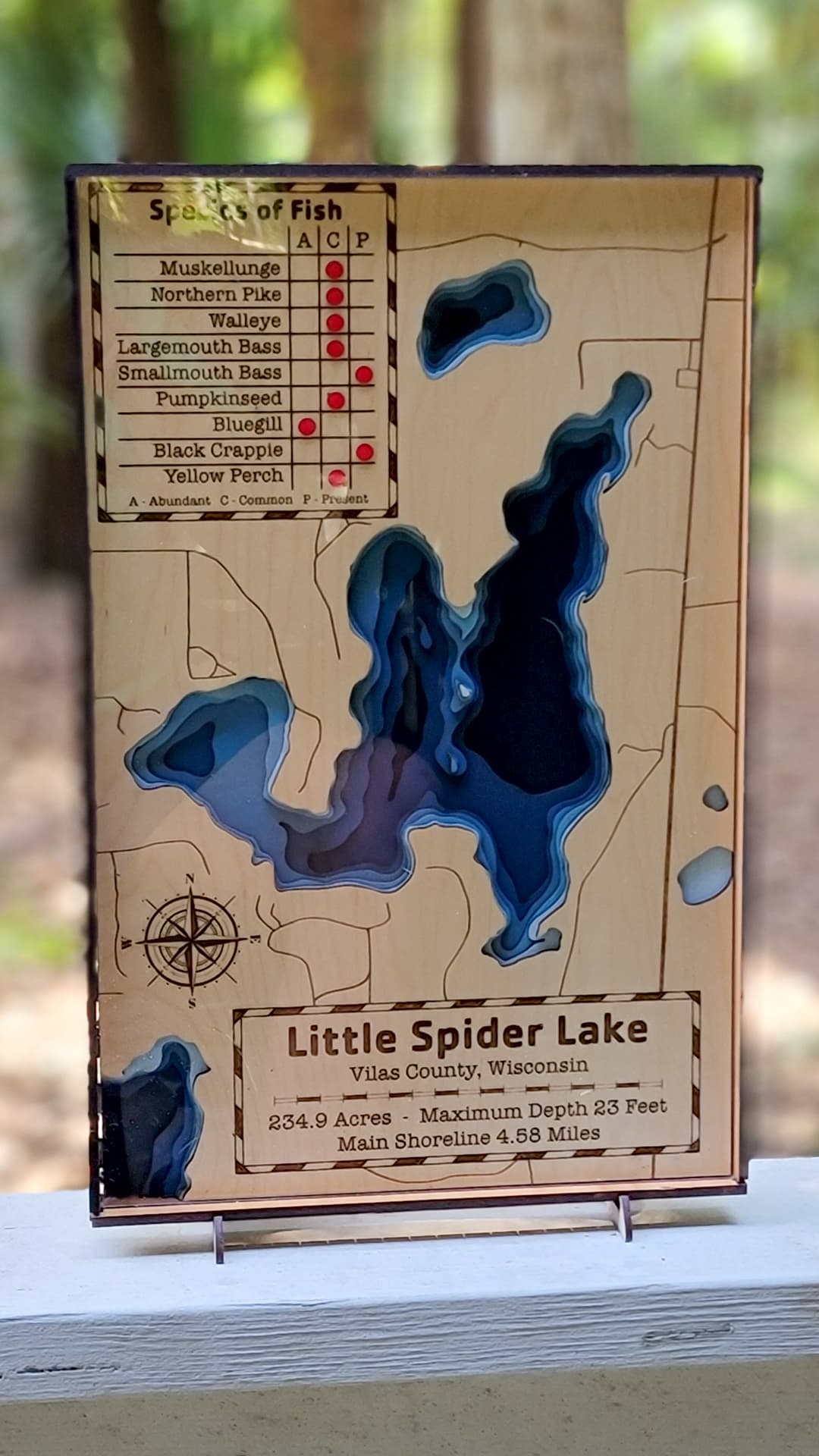
cherry. Medium ![]() clear acrylic for the front. Everything cut and engraved on Glowforge except frame and back, which was too big and cut on Mira 9. Commissioned as a retirement gift for someone moving to this lake. Lake layers done in illustrator using old Wisconsin DNR map.
clear acrylic for the front. Everything cut and engraved on Glowforge except frame and back, which was too big and cut on Mira 9. Commissioned as a retirement gift for someone moving to this lake. Lake layers done in illustrator using old Wisconsin DNR map.


39 Likes
Classy, which is totally predictable considering the artist.
13 Likes
Beautiful!
The painting in layers and just where needed is the kind of time and material saving step that makes so much sense, and yet it hasn’t occurred to me.
13 Likes
Fantastic!!
10 Likes
Amazing as always
9 Likes
Very nicely done. I like seeing all of the steps in your design too.
9 Likes
Love seeing the process. It turned out wonderful!
9 Likes
This is lovely. I’m sure it will be very meaningful to the new inhabitants.
Thank you for sharing the photos of the painted layers. Very clever.
10 Likes
Lovely work. Love the pics of the layers. Thank you
8 Likes
Oh, thank you for the step-by-step build!
9 Likes
Same here; every time before I’d think to myself, “I’d love to do one, but I don’t have that many different acrylic colors!” ![]()
10 Likes
Bathymetric maps always please me. Lovely!
7 Likes
I just went to Home Depot and got 8 or 9 sample-sized containers mixed with different shades of blue from the swatch stand. Not exactly the cheapest way, but now I have enough blue for many maps.
10 Likes
Wow these turned out great! On my ‘to do’ list someday!
8 Likes
I love this, and would like to make one of kaelepulu pond on Oahu, is there a good source for this data?
5 Likes
For lakes, I don’t think so. Maybe there is for Hawaii, but I haven’t found a good one for lakes I’ve done. I draw the lake levels by hand. I’d love to find a way to get the Bathymetric data without having to trace the lines manually off DNR maps. There may be commercial mapping software but for inland lakes, but I haven’t seen one with export capabilities. If anyone knows of a way, I’d love to know about it.
6 Likes
Thanks!! I haven’t found a depth chart map of this water body unfortunately. I guess I don’t need the QGIS app I downloaded. ![]()
5 Likes
Lovely! Thanks for showing the assembly by layers- I’m among those who thought they were all acrylic!
6 Likes
Oh, very nice! I like the addition of the fish species chart.
7 Likes
Adding my learnings here to follow and hope others can contribute…

Shows how to get the depths of lakes and other water. The source he uses is from Nautical Charts ArcGIS Web Application
Another video of his sourced from OpenStreetMaps
")
Also, this guy Steve walks through a VERY easy tutorial on street maps and such. I was able to follow and easily do this in Inkscape in minutes! He uses Snazzymaps

There doesn’t seem to be a lot of step-by-step tutorials and I guess folks want to keep it close to their chest as these seem to be high-priced items! (Booooo for not sharing!)
10 Likes