Bathymetric Map of Lake Murray, South Carolina

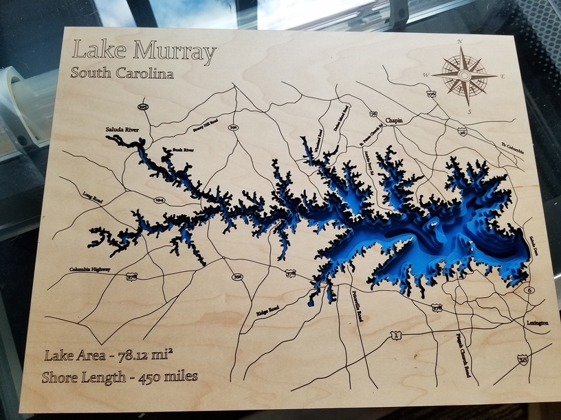
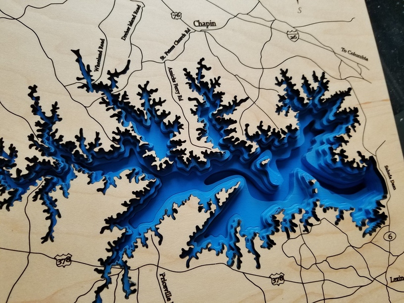
I’ve been learning Inkscape by tracing a bathymetric map of Lake Murray in South Carolina, so I was ready when I got my Glowforge on Thursday. The top couple layers are Proofgrade Medium Maple Plywood, and the rest are Home Depot 1/4 inch plywood, b/c they are supposed to represent a bigger drop in depth (nothing to do with it being dirt cheap…)


The negative pattern looked pretty cool too:

If anyone lives around here and wants the .svg let me know. Heads up, the islands are super annoying to keep track of and glue down.

Update: Here’s the file for anyone who wants it, just hide all the layers you don’t want to cut.
Lake%20Murray

Hmm…I’m new to the uploading thing. When I upload the .svg file, it just shows up as a .png picture. Anyone know how to share the actual file?

80 Likes

This is amazing! You did a fantastic job on it. And I agree, the cutouts look great too. Definitely do something with them.

1 Like

Well done. Im from Lexington; its nice to see something close to home

3 Likes

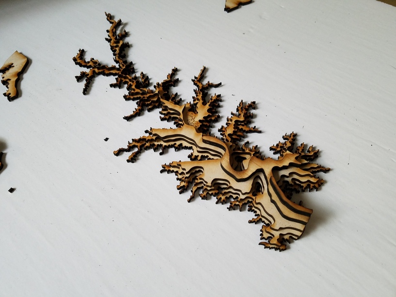
I’m working on similar layered designs, and to keep track of the “floating” pieces I figured out I would just score numbers or letters on to them (except for the top layer) and, if needed for really complicated designs where accuracy matters, cut additional locating holes in those lower layers, that will just fit a toothpick.

2 Likes

Amazing! Been trying to work in reverse and do topo’s on my Islands. Great work and stunning.

1 Like

Beautiful.

1 Like

Just beautiful! What a treasure.

Wow! That’s incredible! :grinning:

I have friends that live on that lake, I would Love the files! This is awesome work!

Well done! This is one of the ideas that made me jump on this train.

Great job on what looks like a tedious project.

That looks beautiful!
I ran into some trouble painting on my birch ply (also non proofgrade), did you have to seal your’s first? Or did you spray paint them? Are all the blue the same color and looks darker cuz of the layering?

No idea on why the svg isn’t showing, but would you mind sharing where you obtained the original map? No shortage of topo data but bathymetric seems hard to find…

This is stunning! And I like how you used thicker ply when it got deeper…it definitely comes through.

Wow – That came out GREAT!

Your upload shows as an SVG – I was able to download it and open it in Inkscape. The document setup was clipping the preview in Discourse (the forum), so here’s a version on a 20x12 artboard:

LakeMurray20x12

2 Likes

For lakes in the US, I’d start out at: https://www.ngdc.noaa.gov/mgg/bathymetry/maps/nos_intro.html
and https://www.ngdc.noaa.gov/mgg/bathymetry/maps/directdownload.html

Oceans and coastal regions: https://maps.ngdc.noaa.gov/viewers/bathymetry/

Smaller lakes can be hard to find – some (but not all, dang it) states have online bathymetry for small bodies.

6 Likes

Thx… yeah, that’s where I had looked, no joy… :frowning:

yeah, no luck for me there, either. and smith mountain lake (SW virginia) is fairly large, too. :frowning:

I just scored the lines from the cut above and aligned it by eye. The locating pin idea is great, and would also help a lot during the glue up.

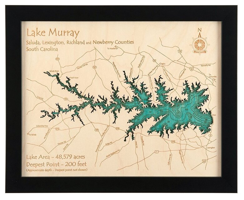
Fun story, I couldn’t find a decent bathymetric Lake Murray anywhere online, but I did stumble on this picture of someone else’s laser etched version. I wish I could give them credit, but I can’t seem to find it again on google.

4 Likes