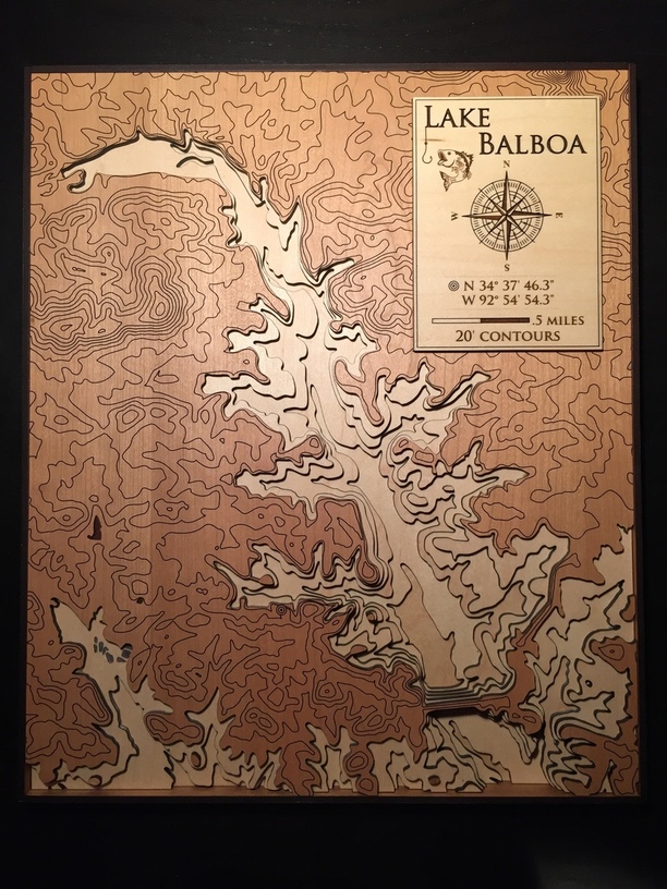
Just finished a project over the course of many, many weeks! And my first extensive project…a depth map of a lake where my folks live.
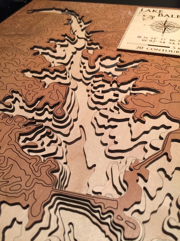
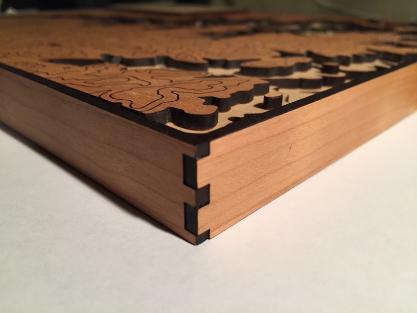
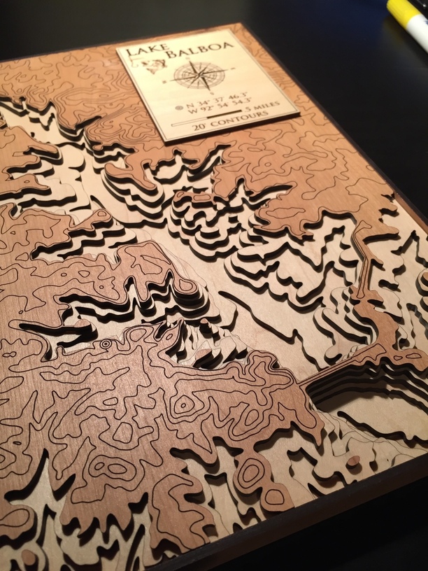
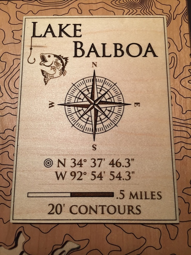
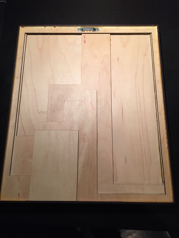
I spent most of the time working on cleaning up the dataset contours, designing the legend, and making sure it was 100% clean, vector design. 5 layers of medium PG maple ply (plus the legend) and one of medium PG cherry ply for the top and sides. Also some material savings with extra cutouts that you can see on the last, back side image.
Only cut everything one time, which was a calculated miracle.
Everything was glued with either Titebond or CA depending on the surface area and holding power needed. The side frame was a tweaked box layout I created in MakerCase, everything else done in Inkscape.
I also properly vectorized the legend compass and will share that file shortly. Thanks for all the forum inspiration along the way!
I admire your dedication and precision. I’ve started working on the map sets several times and just can’t keep it up because of the challenge of getting a clean file. Bravo! And a clever display.
I downloaded a lot of data from nationalmap.gov but the lake depth data was nowhere to be found, since all of those maps were post creation of the lake (Corp of Engineers in the late 80s/90s). I finally found an old topo from before the lake was dammed up on caltopo.com . Had to trace the raster contours into vectors. I was short on time, but found a guy on Fiverr who did it for me overnight.
Thanks…yes, even though it was very tedious, I learned a LOT. About map data. About Inkscape shortcuts. About precise vector editing. Next time it’s surely going to go much faster.
Also I am up past my bedtime browsing the forum, as evidenced by my initial read of your username as “coloracadaver,” which I found a bit disturbing. I’m really glad that’s not what it actually was, and I think I’d better go to sleep now!
Yeah, that’s an idea that I thought was pretty interesting myself. It’s well suited to the multiple layers…were you thinking more of an volumetric or more like a line plot style?
Those are both very cool but if you had a volumetric as a .stl file that you could cut each layer in the acrylic it would make an awesome display when planning a trip or showing folks where you went in photos.
Making that Thai cave as a historic reference would be very cool as well. If it could have been done while at the top of the news could have sold to media for a large sum.
Thanks so much! The separate legend plate was totally on the fly, but I really like how it came out, especially with the color contrast. I ran out of time, but I wanted to attach it with magnets so it was removable and add details on the backside. Next project…
Agreed. With the volumetric approach it might best to use a horizontal stack instead of vertical, depending on the type of typical cave passage in the data. And I have access to all sorts of raw cave mapping data. Hmm…


