I love maps and processed a number of World Map projections, U.S. Continental map files and indivual state files for my personal use. The U.S. Continental and state files are composed of lines and polygons for most map layers (boundaries, roads, streams, political units, etc.) I have used this data in my laser and cnc router activities.
A few years ago I made this data available thru a website. Files are SVG format and all data layers are detailed and registered. All revenue was donated to support Public Domain software like Inkscape and QGIS.
There are many map sites that have free data, but typically, it is not highly detailed, or all the map layers are not registered. There are also sites that have similar data to what I have posted, but it is much more expensive. There are also government sites, but then you will have to do all the processing; formatting, projecting and clipping, time consuming work.
I will be removing the links to the E-Commerce download site early next month so these files will no longer be available. If you are interested in this map data, it won’t be available much longer.
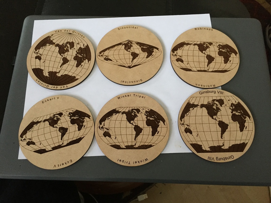
Attached are photos of some things I have lasered with this data, most of the “Super Amazing Stuff” was given away, so the attached photos are pretty basic. These files are NOT GlowForge ready files. They are SVG vectors, “raw map data” that allow you great flexibility in designing a World, U.S Continental or state map that meets your specific needs.
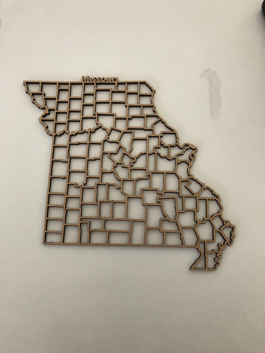
I love those too!!! Those are county boundaries,but it is also possible to make them with roads or streams as you know!!! The Continental file allows you to select regions of the country and make them for larger areas. If you ever want to do region of the U.S., contact me because it is easier to use a GIS package than Inkscape or Illustrator to clip the file.
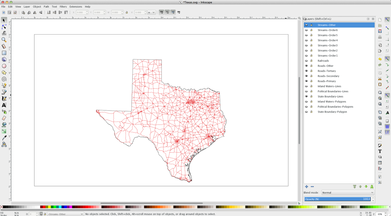
Thank you, thank you! I have been searching for a decent SVG of Texas roads for months! I made an edge-lit Texas map night light this summer for my Texan nephew who has an autism spectrum disorder and LOVES road maps, but I couldn’t find a good quality map and had to settle for one I wasn’t really happy with. I promised him when I found a more detailed and accurate one I would replace the acrylic piece. I tried to figure out how to use the public domain data, but never could figure it out adequately I guess I should have asked here to begin with!
Here is an image of the layers you will get in the Texas file. If you use Inkscape, the layer names will appear. If you use Illustrator, the layer names get dropped when you open the file, one of the reasons I prefer Inkscape.
Image of Texas file showing all road layers-Primary, Secondary, Tertiary and Other. I can send Screen Captures of each separate road layer if you need to see each separate layer.
Are the individual state files the same data as the continental file, but clipped to that state? Or is there more or higher resolution data in the state files? Assuming no AK/HI in the continental file?
I’d also be interested in the entire set of states, can you let me know how that might work?
Is it possible to get town boundaries in addition to county boundaries?
Thank you for the message! I did get three! I will definitely show my husband and hope that he agrees on buying the set! What a great set of images you have created! Thank you for taking the time to message me, sorry it was a bit finicky it seems
I might have to take you up on this. My rodeo boss wants me to build him a TX coffee table with all the counties cut out just like your Missouri example. Apparently he has saved some soil from every county he rode a bull in back in the day. He wants to eventually get soil from every county he’s visited and put them in the proper map holes. Haven’t figured out how to get a Texas shaped glass topper but your map might be a good way to start the build.