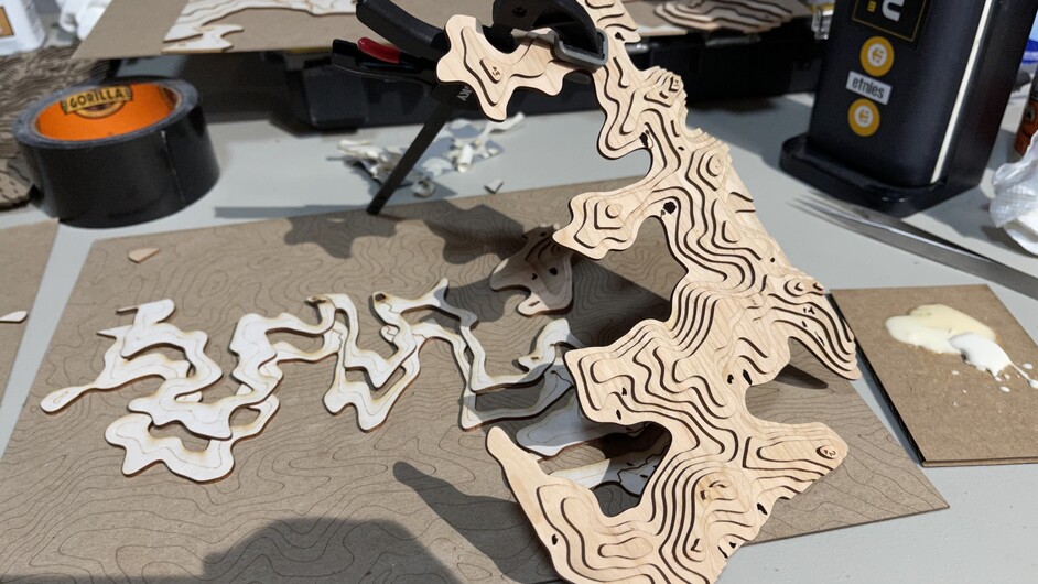
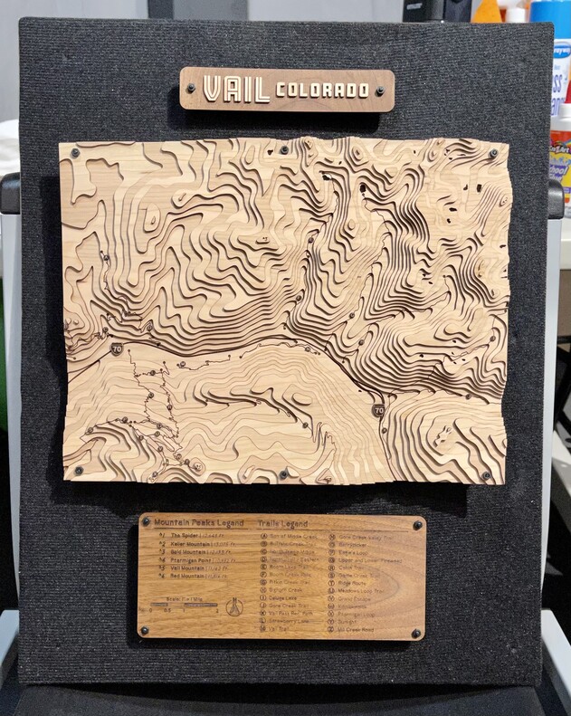
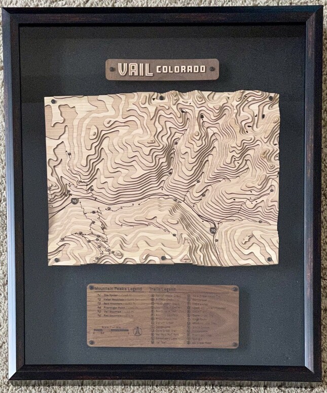
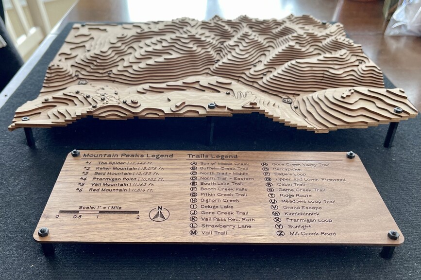
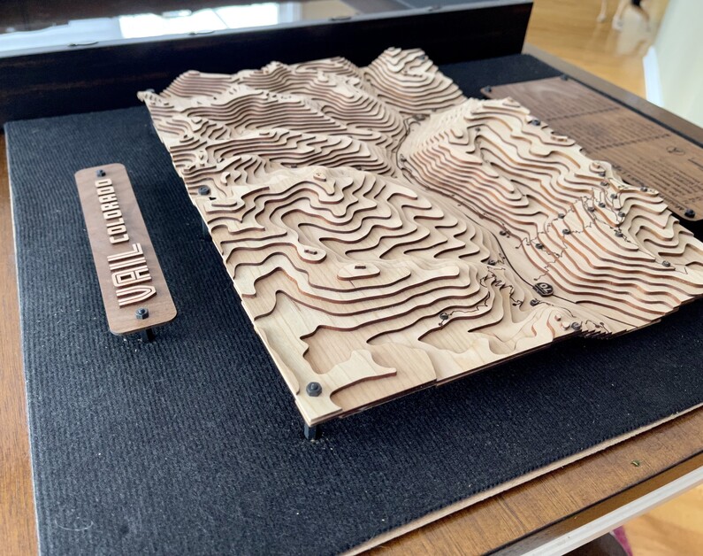
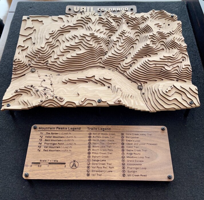
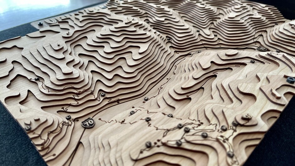
Made this for my brother in law and his wife as a christmas gift; they like hiking a lot of the trails around Vail, CO. I won’t bore you with all the details of the data manipulation, but the model has the topographic contours, hiking trails, I-70 highway, lakes, and peaks marked/labeled in it.
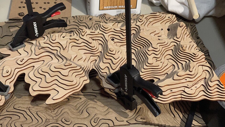
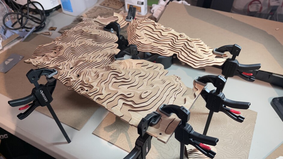
The project is 1/16" cherry and walnut woods, walnut finished with Danish Oil. I was going to finish the cherry with it too, but after assembling, I felt it looked better unstained. Wood is glued together and then mounted to the backing board of the shadow box with some small standoff hardware. Because I forgot to include something for scale, the topo part of the project is 10"x13", the overall piece fits into a 16"x20" shadowbox. The actual scale of the topo map is 1"=1 mile (horizontally; I didn’t do the math to figure out an accurate vertical scale ). And now to the pictures!
Thanks! Material saving technique too:) With this process, the whole topo model only takes 2 sheets of material, as opposed to cutting each contour all the way to the edge of the 10"x13" board.
Yeah it’s a beautiful area. I initially was going to do it focused more on Vail (south of I-70), but then I found out their favorite trail in the area is Booth Creek Falls (ne of Vail), so I had to adjust everything-luckily it was while I was still in the file making phase of the project.
Simply incredible. Visitor center quality as a gift. If they don’t think you are the best after this they cray cray.
You found your way here, that means you can if you want to bad enough. Lots of links to tutorials here on the forums. My problem with something like this is I just don’t have the patience.
Thanks! Well, I already use GIS software as part of my job, and I do trail planning, so already knowing where to get some of the data and how to work with it def made it require less patience for sure. That being said, I’m happy to share info and advice if anyone has questions-just didn’t want to add a bunch of boring text to the first post
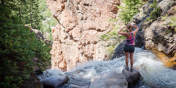
Yeah it’s a hidden gem. I’m amazed that place doesn’t have a higher number of visitors, but then if it did there would probably be a body count. One wrong step can be very very bad up there.
Man people are crazy, that would have definitely been the last time anyone saw her if she fell.
That looks pretty sweet, I’ll have to check out the trail come spring. I’ve spent more time hiking either closer to Denver/Conifer/Evergreen, or near Glenwood, or all the way out on the Western Slope biking by Fruita and GJ. I really should do some more hikes around Vail though.
Late spring, or bring crampons and or snowshoes. It won’t really melt out until June 1 or later. Most of the trails north of I70 gain altitude very quickly, it looks inviting at the bottom but snow and ice waits for you a half mile in.
How beautiful; well done. My best memories in the Army were flying along 50’ above the trees, with 1:25,000 maps (Alabama) or 1:250,000 maps (Germany). Having something like this would have made my map reading skills so much easier to learn.
In college for site grading class, I remember making a clay model of a sloped roadway, then putting it in a tub, adding water, trace the water line, add more water, trace, etc. to see what contours looked like on a 3 dimensional model.