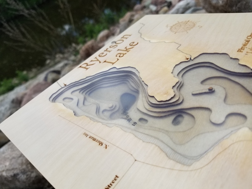
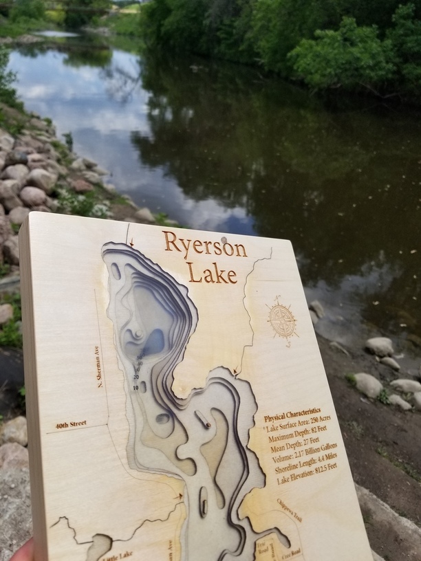
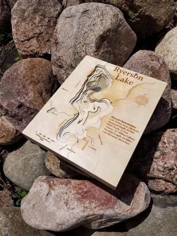
I made this depth chart from 1/8" Baltic birch plywood. All layers were cut and engraved on my GF. I used resin to fill the lake layer cutouts. Each layer was individually filled and sanded, then I laser engraved the depth and filled the engrave with black paint… so after all the layer were poured it looks like the depth numbers are floating in the lake. Would love any feedback or future ide!as anyone has. Here is a link to the YouTube video on how I made it.
Where did you get the TOPO of the lake from to make the files? I want to make my Brother-In-Law one of his favorite fishing lake and I cannot find a good source for the map that I can export.
Thanks! I found a jpg of the map online and then used that to create an SVG by tracing it in Adobe illustrator. I show part of the process in the YouTube video. Good luck with yours and let me know if you have any other questions.
Thank you! A portion of Lake Superior (Milwaukee Harbor) is on my short list of projects. At some point I’m sure all of the great lakes will be on my list
I almost did that but wasn’t sure of a good method. Someone on YouTube suggested printing on transparencies and cutting out the image which I think would work.
I just looked in my DEM library and I have Lake Superior data. My image to vector conversion software is on another computer. I will try and convert it in the next few days.
What contour interval do you need?
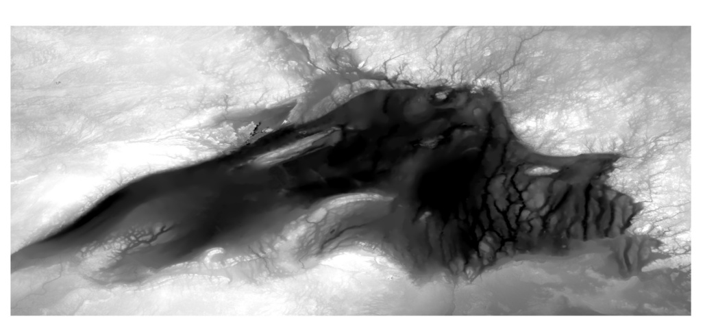
Here is a photo of the data, it includes the land around the lake too.
I always want to do one of these depth maps to scale, but the angle of repose in almost every lake I look at is so shallow that I’d meed to make the map like 5’ across. Bummer.
Yeah I get it, but I was being a purist, and wanted true scale. Moving on to a new project until I find the right lake that is super deep and small surface area
I just noticed that I accidentally responded to myself!!! LOL!
That is an abuse of technology!!! Here is what I was trying to respond directly to you!!!
I just looked in my DEM library and I have Lake Superior data. My
image to vector conversion software is on another computer. I will try
and convert it in the next few days.
What contour interval do you need?
Here is a photo of the data, it includes the land around the lake too.